Parc de la Villette1982-1998
- cultural
- historic
- industrial
- open space
- place making
- public space
- Masterplan
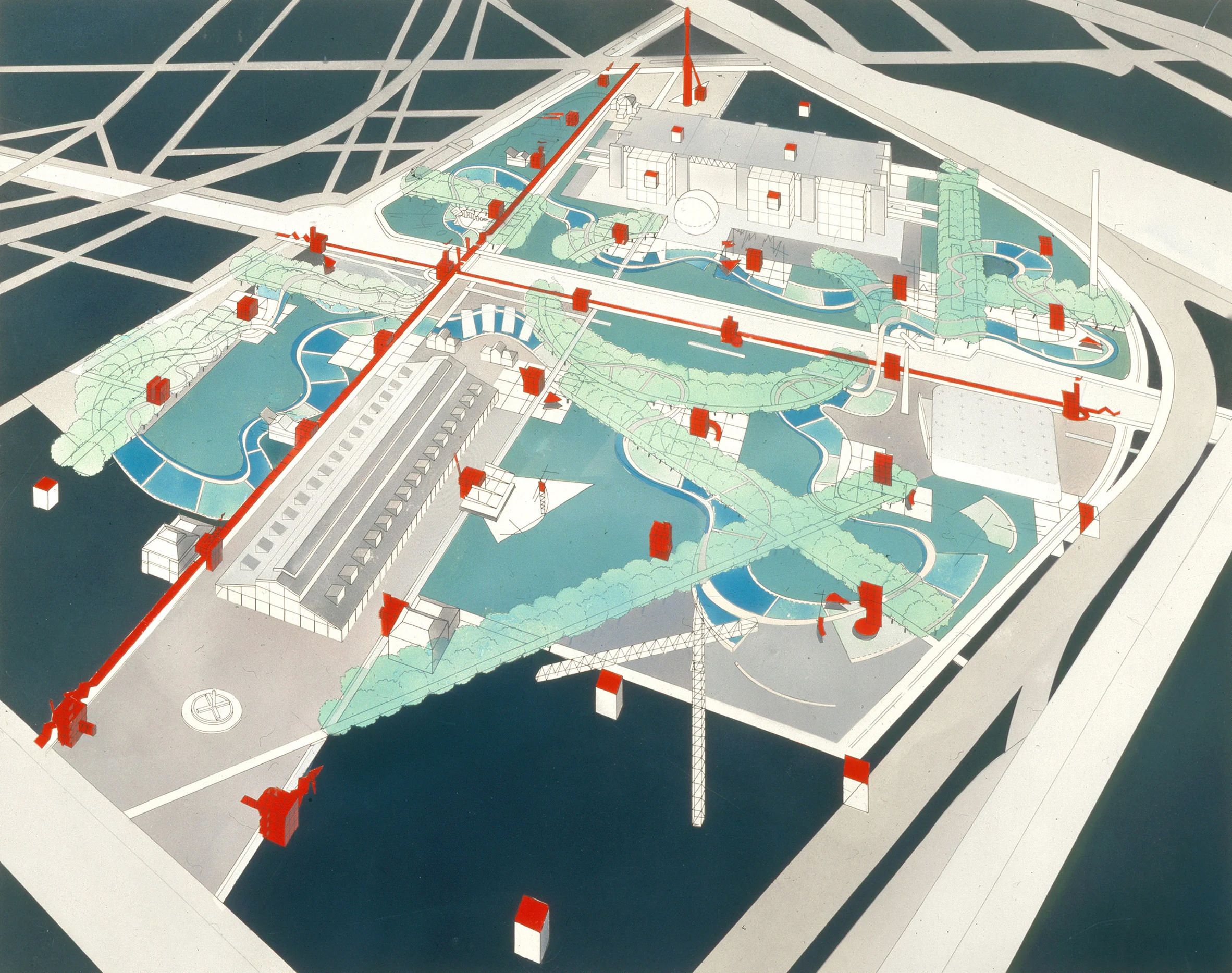
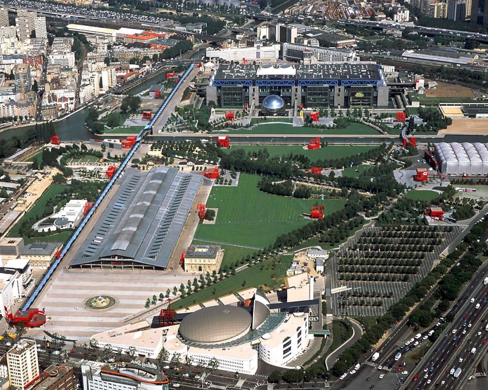
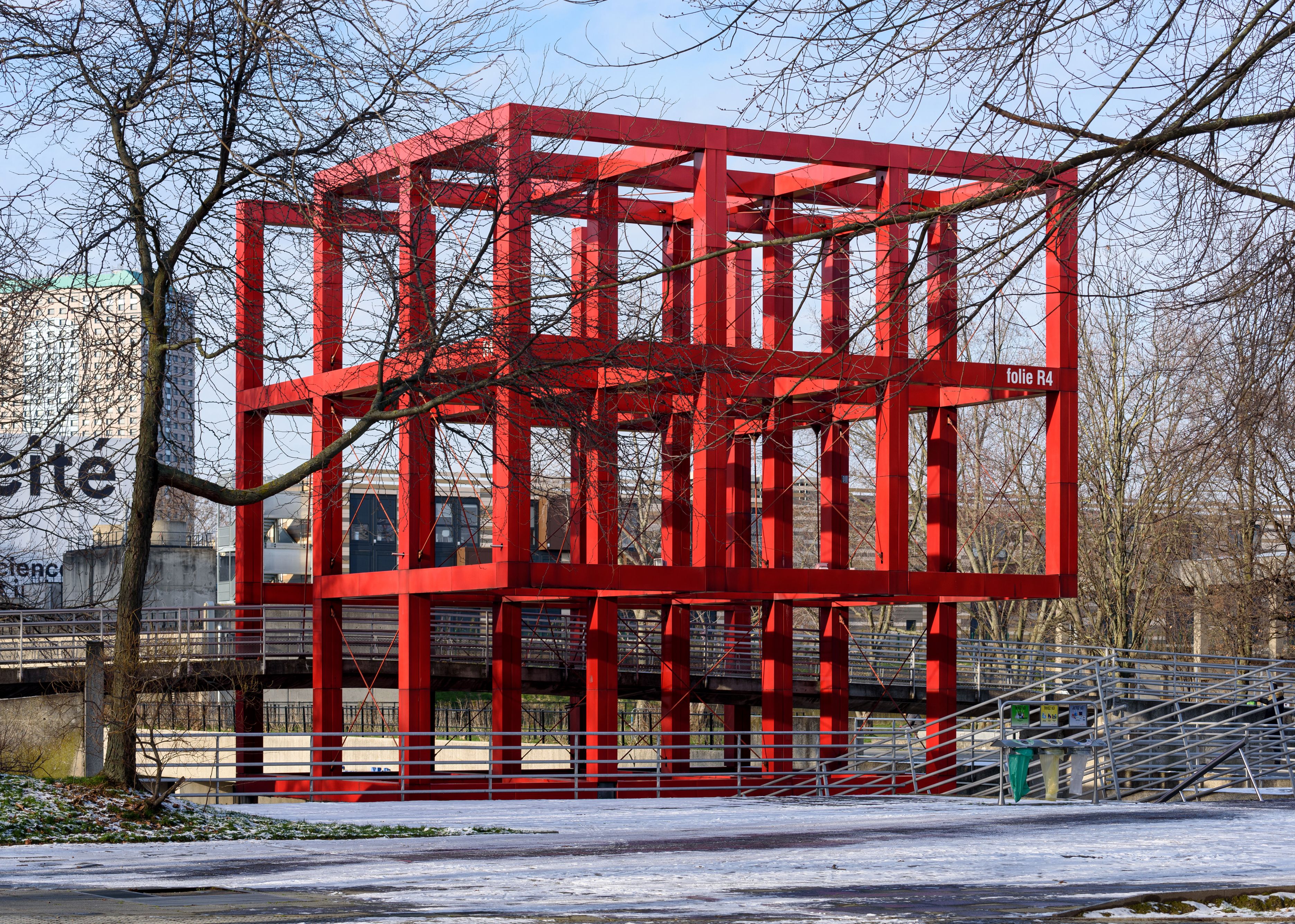
La Cité du Sang, or The City of Blood, was the 19th-century colloquial name given to the area now known as Parc de la Villette due to its history as the site of the largest complex of slaughterhouses in Paris - Les Abattoirs de la Villette. This massive industrial complex became the central hub for meat processing, symbolizing the gritty industrial side of Paris. By the mid-20th century, the widespread adoption of refrigerant cooling allowed livestock to be processed where they were reared and shipped directly to retailers. This development rendered the abattoirs obsolete, leading to their closure in 1974. This set the stage for a significant transformation of the area, spearheaded by President François Mitterrand’s Grands Projets—a series of urban development initiatives reminiscent of Haussmann's major reorganization of Paris. The renewal began with the announcement of buildings such as the Cité des Sciences et de l’Industrie, Europe’s largest science museum at the time, and performing arts facilities like the Cité de la Musique. Plans for an interstitial park progressed slowly until Mitterrand's election in 1981, after which the scope of the buildings expanded, and an international competition was launched to design a 21st-century urban park. Bernard Tschumi was selected from over 400 entries, including those from renowned architects like Rem Koolhaas, Zaha Hadid, and Jean Nouvel. Tschumi’s design was inspired by the orthogonality of the abattoir complex and the canals, expressed through three superimposed systems: points, lines, and surfaces. The points, represented by the red follies, signify disjunction, while the lines, which parallel the perpendicular canals, facilitate pedestrian movement through galleries stretching across the site and providing sequential views of themed gardens. Lastly, The surfaces are represented by expansive grassy flats. Despite its success, the project is not without criticism. Critics argue that while the design may expand architectural boundaries, it fails to innovate in landscape design, often prioritizing theoretical concepts over practical, experiential elements. Key figures in landscape architecture, such as Elizabeth Meyer and Peter Latz, criticized Tschumi's simplistic view of nature and dismissal of traditional landscape elements. The park's distinctive red follies have aged poorly, and the design's reliance on abstract architectural theories has led to a space that some find spatially uninteresting and detached from its urban and natural context. Nonetheless, Parc de la Villette remains a notable and debated example in urban park design.
Project Leads
- Bernard Tschumi Architects
Organizations
- Bernard Tschumi Architects
- French National Government (Presidency)
- Reichen et Robert Associés
- Chaix et Morel
- Ateliers AFA
- Établissement Public du Parc et de la Grande Halle de la Villette (EPPGHV)
- French Ministry of Culture and Communications
- La Cité des Science et de l’Industrie (CSI)
- French Ministry of Industry, Post and Telecommunications
- La Cité de la Musique
- French Ministry of Culture
- Council of Presidents
- Alexandre Chemetoff & Associés
- Bernard Leitner
- Gilles Vexlard
Stages
- Construction
Site
Typology
Masterplan, Urban Park, CulturalLand use type
Open SpaceSize
125 acresGross floor area
250,000 sq. feet of folies and covered galleriesCommunity Infrastructure
- public park
- cultural programs